Services
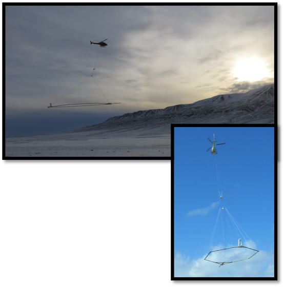
Helicopter Electromagnetic
Electromagnetic can detect, locate and map:
- Aquifers
- Mineral deposits
- Soil contamination
- Aggregates
- Fractures and faults
- Salt water encroachment
- Paleochannels
- Groundwater recharge
- Water depths (bathymetry)
- Oil and gas
- Site characterization
- Landslide investigations
- Pre-construction planning
Valuable Attributes
- Dual transmitter modes so that it is possible to map at depth and the near surface, concurrently.
- Fast turn-off time and early time data.
- Advanced deliverables within 48 hours of acquiring the data for early review so that decisions on flying in-fill or other lines can be made while the crew and system are still on site.
- Depth of penetration can be customized to suit the geology and the systems can be configured remotely in-flight
- The extremely high signal to noise ratio and close-to-square-wave-form contribute significantly to the delivery of high resolution data and increases confidence.
- Negligible signal drift.
- One-time calibration procedure eliminates the need to conduct high altitude calibration/verification flights at regular intervals during each sortie.
- Data levelling and post flight corrections are minimized or eliminated.
- All sensors, including the magnetometer and spectrometer are mounted on the rigid carrier frame ensuring all measurements are recorded close to the ground for increased accuracy and the collection of the highest lateral and horizontal resolution obtainable.
- No operator is required in the helicopter. This reduces weight and fuel consumption and serves to reduce risk and cost as the pilot is the only one aboard the aircraft during survey flying.
- The system is very robust and can fly in challenging weather conditions.